Sunday, August 31, 2008

Maybe the Last Post? Port Augusta, Aldinga, then home


At home, sitting near the kitchen radiator. Outside the rain is driving hard against the window with gusts of wind tearing at the eaves. The old clock on the wall goes about its business, metronomically, as usual. Months of planning and months in the execution, brings us, just as we knew it would, to this point. It’s finished! So this last post will carry some of the anti-climax we felt when we had crossed back into the east, with nothing but bitumen ahead.

The transformation as we closed with the coast from Coober Pedy had been swift, and now a further greening took place. Stone ruins were commonplace, and some beautiful little townships, like Burra, should not be missed. Burra, especially, is famous as the main producer of copper in the world at the end of the 19th Century, and is now famous as the first town in Australia to be conserved under the International agreement (ICOMOS), and known here as the “Burra Charter”. Architectural historians get excited over the stuff!

We spent a night in the forest at Wirrabra, trying to get warm beside a damp pine fire. The desert Mulga fires of the week before, where all you had to do was scoop some leaves together and drop some small dead branches on and you had a hot cooking fire, were sorely missed. The first swirls and flurries of rain tapped on the Tvan roof overnight. The temperature dropped further and the damp penetrated our clothing. Really this was a good way to wind down, with a dripping walk in the old nursery/arboretum and timber workers' pioneer cemetery. Our next call was Clare, and we enjoyed Skillogalee and Kilikanoon wineries, and our last meal in the open – well, huddled in the van, and quickly to bed with a raunchy Wilbur Smith novel. Helen always insisted I read out loud the raunchy bits! Well, when you’re into bed at 8pm what else are you going to do?!

The journey from Clare, through the Adelaide Hills and the Torrens gorge, is a delight, and it was a relief to clear the suburbs of our first major city in four months, without too much pain, and head for sister Margie’s at Willunga Beach. The weather had brightened up and by the Sunday it was sunny enough to indulge a little, and see the coastline from the air; Helen shouted me a trip aloft courtesy of an old Tiger Moth, from the most up market little aero club I’ve ever seen. We broke the journey to Victoria with a night in Robe, having a great fish meal at The Caledonian Inn (go there), where we enjoyed a long yarn about our lives with each other. You get to cover some interesting topics when together like this. Refreshing, it is. Well that’s what it’s all about isn’t it? Don’t dally. “Just do it”, as that dreadful ad says.

Our second last day in the car was the longest drive we've had for the whole trip - along the coast via the Coorong in South Australia through to the Great Ocean Road in Victoria where we wound our way in the dark to get to Geelong for a meal with the newly engaged Andy and Michelle. Another long suffering sister Robbie and husband David left the lights on for us to stumble to bed in Wallington. After a second breakfast with Helen's mother in nearby Point Lonsdale next day we felt able to gently wend our way home to be greeted by ancient cat Smog and far too many rabbits.

We’ve really enjoyed writing this blog, and we’ve had some very kind comments from our readership! Thanks especially to those who sent us comments on the blog itself – some from “out there”, and especially Etch! We’ll think very hard about doing one again. Cape York 2009. What do you think?

From Coober Pedy south to Port Augusta

The corrugations wouldn’t let up until we had left Mabel Creek Station, leaving us with just 46kms to do to Coober Pedy, on good gravel. The landscape, becoming gradually more and more harsh, gave up all pretence at vegetation and turned into a stony desert NASA might have familiarised its astronauts in. How refreshing it was though, to rediscover our vertebrae, one by one. Within moments we were shelving our recent crossover memories and scanning the horizon for signs of opal workings. The country for miles around Coober Pedy is shaped by hand; piles and piles and piles of cone shaped mounds, gypsum pale against the otherwise reddish brown dirt, piles that are testament to so many individuals who have turned this place into gruyere. Don’t go wandering off, there are no fences!

We felt duty bound to spend a night in Coober, and certainly the washing machine at the park got a good workout. We downed a half metre diameter pizza at the park cafe, to the accompaniment of the only Olympics TV watching we had. Wasn’t that a blessing. But which pharmaceutical company sponsored the Jamaican mob? Of course we did the tourist bit and went through an old mine, complete with underground household and all the modern conveniences. However our thoughts were firmly on the remaining road ahead so we left CP after one night and aimed for Port Augusta. The Stuart Highway runs through country more desertish than the Anne Beadell, past dry salt lakes. On the way Woomera has some interesting recent rocket range history so we diverted briefly, and fortunately as it turned out, because we were able to purchase the last copy they had, of Len Beadell’s video. As Woomera was LB’s HQ it was a neat conclusion to see the museum there, with footage and photographs of that period. The township is now being revitalised by miners and police.

One of the fascinating things about this travelling is the people you meet. At the Port Augusta caravan park there was a fellow on his own, Toyota Land Cruiser WA registered and an old camper trailer rather worse for wear. Helen said to me, “that chap has a tale or two to tell” and went to chat. Within the hour we were hearing his extraordinary story against adversity, featured by George Negus on one of those “Australian Story” type of TV shows. We saw the DVD! Phil McFarlane is a VietVet, owns 45,000 acres just north east of Perth. Crushed by his rearing horse after being spooked by a snake, his hips, legs, one arm and all his rib cage broken. Spurred on to crawl over a kilometre for help, with the thought of his unborn child firmly in mind. His wife goes into a psychiatric home and he is cared for by his two young sons. His leg gets infected, and after 41 operations and eight years of pain he begs them to take it off. Now, equipped with the latest hydraulic self adjusting leg, he goes about his farm business without a problem and with an amazing attitude to life.

We both enjoyed a morning at the Australian Arid Lands Botanic Garden, particularly the Eremophila walk, and were interviewed by the volunteer brigade working in the Nursery because they were interested in our recent crossing of the Great Victoria Desert for their newsletter.

Leaving Port Augusta we turned inland away from the main highway, and climbed through the Horrocks Pass, up into the South Flinders Ranges. Here all was green and lush after long awaited rain in SA.


Friday, August 22, 2008

Crossing over: the Great Victoria Desert on the Anne Beadell Highway


This will be a post that some might find tedious because I want to include some technical sort of stuff, so I’ll put headings in. This makes it look a bit like a report I’m afraid.

Len Beadell, Surveyor. The story of Len Beadell is well known amongst Centralians, and those who enjoy travelling throughout those desert areas of the Northern Territory, South and West Australia. For anyone contemplating a journey there for the first time, his books are almost compulsory reading. Why a TV company hasn’t commissioned a series about him I don’t know. He is regarded as the last great Aussie explorer, and briefly, this is why.

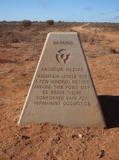
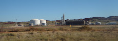
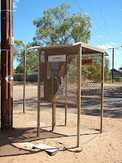
In 1947 Len was a surveyor with the army, charged with the task of finding a place to drop an atomic bomb. Before he could do that he had to locate a weather station The Giles Weather Station outside Warburton) so the bombasts could be sure they weren’t going to kill anyone in the process or the aftermath. On the basis of Terra Nullius of course they didn’t give a rat’s about the locals. That’s another story. Len was also asked to establish a firing range that would extend from Woomera as far as the Indian Ocean, with a hundred miles to spare each side. The Brits, and later the Aussies, Italians and Americans all came with their whizz bangs and let fly in the general direction of India (until as recently as the mid seventies).

So with his Series 1 Land Rover, a bulldozer and grader a day behind him (he called his team the “Gunbarrel Highway Construction Party”), he surveyed and constructed over 6000kms of roads through what until that time was unknown territory. Whilst he had the whole resource of the establishment, with a workshop at Woomera at his beck and call, he essentially did the work on his own, given that he did the trail blazing, winter and summer, hundreds of kilometres from his local base, over a period of many years. His prowess as a bushman must have been extraordinary. Anyway, for one year he had his English wife, Anne, and their months old daughter Connie Sue, with him as he worked. Len named two of his roads after them, the Anne Beadell running east to west, and the Connie Sue running North to South, meeting at Neale Junction, near the western end of the Great Victorian Desert (28’30”S:125’50”E).

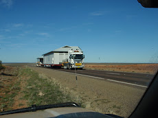
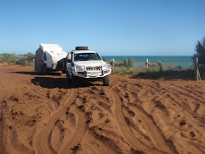
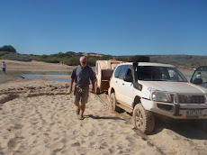
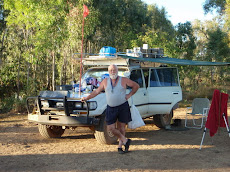
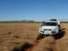
The Anne Beadell Highway - highway is a joke of course, it is a track. It starts 142kms east of Laverton and ends at Mabel Creek Station 46kms west of Coober Pedy. A distance of about 1330kms. Before 2004 there was no fuel along the route, but now a modern roadhouse has been established at Ilkurlka about 550kms in, from Laverton. Not knowing what to expect on fuel consumption we carried 100L diesel on top of the 180L in the Prado tanks, in case fuel was not available for some reason at Ilkurlka. Water, we had 70L in the van tank and a further 60L on board, aiming to use no more than 10L/day. We had read somewhere that the average speed was 54kph. Bulldust. A couple we met did do the journey in 6 days “and I wish we had taken longer” she said. Quite right. We aimed to do it in eight days with a day set aside for observing floribunda; as it turned out we did do it in eight days but did the flora spotting, of course, as we went. To drive the route you must obtain permits well ahead of time, from the various traditional land owners, the two conservation parks that you pass through along the way, and from the Defence bods, who control access to the Woomera Prohibited Area.

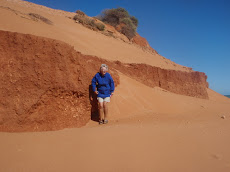
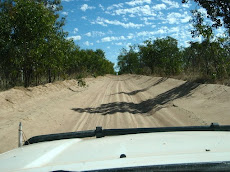
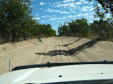
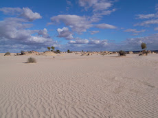
Track conditions vary dramatically, and we had been forewarned by everyone we met who had made the trek, about the “horrendous” corrugations to be found east of Emu (where Len Beadell established an airstrip and tented township to serve the first two atomic blasts at Totem 1 and Totem 2, before he went on to survey Maralinga for the series of tests conducted in the late 1950’s). We had Guest’s 4WD in Melbourne prepare the Prado because they take group tours of TVans across that way. They installed a special combination spring/shock absorber arrangement that has been developed for corrugations. We also put heavier duty shockers on the van (Koni all round). The track is generally easy as far as Neale Junction, with some heavily corrugated but thankfully brief sections. Average speed was around the 35kph mark. From Neale the surface worsens, and from Emu it is very badly corrugated, the average here dropped to about 20-25kph. The surface is constantly changing though. Basically Len fed his road parallel with the seemingly endless sand dunes, and did some serious dune crossing east of Ilkurlka for a distance of perhaps 100kms. Between the dunes, in the swales, the surface is either gritty or stony, or rocky depending on the geology, and changing between surfaces every 200 metres or so. Over the dunes, deepish soft sand.

Track width over the eastern section becomes narrow and winds tightly through mulga scrub, scraping along the vehicle if not ever vigilant. Bends are a potential head-on, but we only met other travellers four times. We fitted a red flagpole to help us be seen.

In my view there are two obvious but so often overlooked essentials, and they apply anywhere but especially here. Lower the tyre pressures – we ran 20/24/20 with load category C tyres fitted – and drive to the conditions. Anticipate the oncoming stones and slow down before you get to them instead of hitting them too fast.

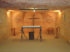
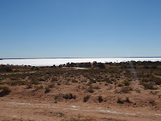
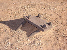
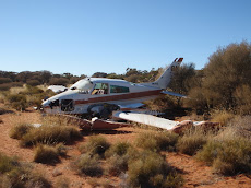
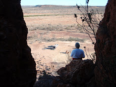
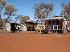
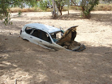
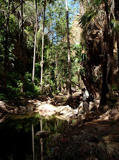
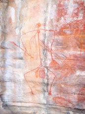
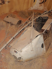
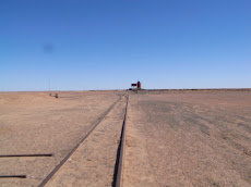
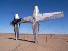
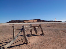
Along the way. There are the goals reached when you complete a section where LB’s characteristic aluminium hand-stamped plaques are found; regular bench marks to check on; old abandoned homesteads at Yamarna and Yeo Lake to explore; the Goldfields Air Services Aztec wreck that went down in 1993 114kms east of Neale Jct, to detour to; a stroll on the salt pans at Serpentine Lakes on the WA/SA border. An opportunity to shower at the campground near Ilkurlka roadhouse (heat your own water); drive the still immaculate airstrip at Emu and fluoresce at the two ground zero sites at Totem 1 and 2 (don’t hang around, and leave the molten rock on the ground!); negotiate the dog fence – at 5400km km the longest fence in the world.

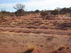
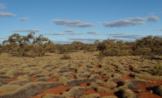
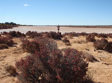
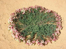
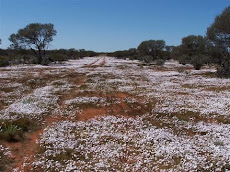
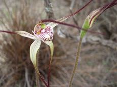
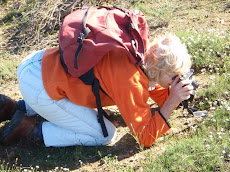
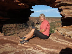
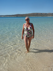
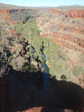
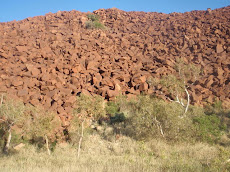
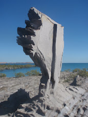
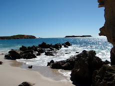
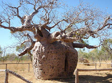
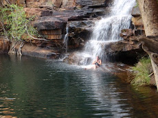
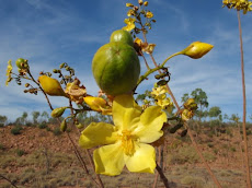
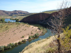
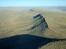
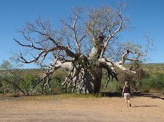
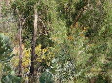
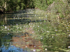
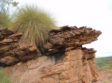
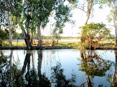
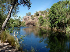
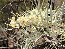
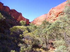
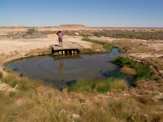
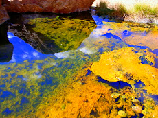
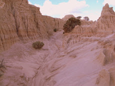
Then there is the landscape. “Desert” is a misnomer. The Great Victorian Desert is a cornucopia of vegetation with its insects, mammals, reptiles and birds that all coexist in a delicate balance against the backdrop of a red dunescape that seems endless, but never boring. It is really beautiful. Just for starters, have a look at this stunning Ooldea Mallee (Euc. youngiana) – the biggest nuts of any eucalypt. There are Grevilleas, Hakeas, many Acacias in addition to the mulga varieties, wonderful Eremophilas and much more (see Helen’s plant website for some examples). The SA desert becomes much more arid and sparse, becoming a stony, barren moonscape approaching Cooper Pedy. One small creek crossing with moisture at Mabel Creek Station demonstrated how the desert can bloom after rain. We were too early for widespread ephemeral wildflowers.

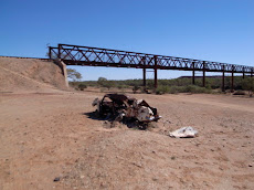
John Olsen, walker extraordinaire When we were back in Geraldton a fortnight beforehand, we heard of John Olsen, a Geelong man, the first to walk from Cape York to the S E Cape of Tassie, now walking the longest east-west route from Steep Pt near Shark Bay, to Byron Bay and then down to home. He was on the Anne Beadell, and rang Macka on his satphone because he hadn’t seen anyone for four days and thought the bomb had been dropped. So we knew we would be meeting John en route. It was tantalising seeing the twin tracks of his 80Kg cart (his own weight is down to 61Kg) in the sand in front of us, day after day. We finally came across him with his Aussie flag flying, 40kms east of the roadhouse (600kms out of Laverton), at the end of the day and at the end of his rope. He had had to drag that cart up sand hills all that afternoon and by his own admission he was jiggered.

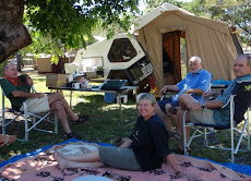
Helen prepared us a large curried beef dinner with trimmings, and we shared a campsite and a good yarn with him. His spirit is amazing. The next day we crossed dune after dune thinking of the task John had ahead of him. He will have achieved a remarkable feat when he gets through those dunes, let alone the completion of his journey. Please go to his website ( http://web.mac.com/johnolsen7000/site/Long_Walk_.html ); he is raising money through Lions, for leucodystrophy, a rare and fatal disease (see the movie “Lorenzo’s oil”).

Highlights? All of the above, plus...

  • calling our son on the new sat phone and being told of his engagement to the beautiful Michelle;
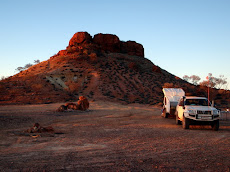
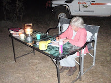
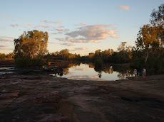
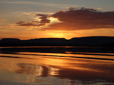
  • a new campsite each night, maybe under a mesa, amongst a grove of Black oaks, with or without dingo howls or wild dogs barking, or watching a full moon eclipse at 4am;
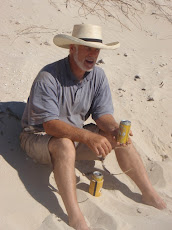
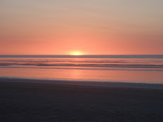
  • how good a whisky can taste at sunset, before some great meals (with a red usually) cooked in the open on mulga fires that burn even better than snowgum;
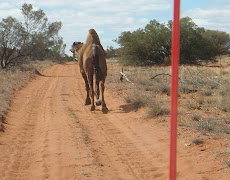
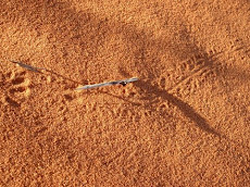
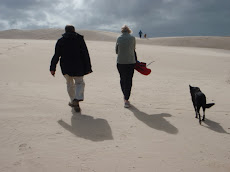
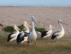
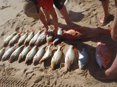
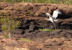
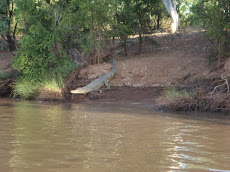
  • wildlife spotting: we didn’t see any reptiles in fact, a few ‘roos, the birds were too quick to identify properly, but animal tracks of tiny creatures/marsupials? were fascinating. Although ferals, camels were exciting to see, especially when pacing along the track in front of you for kilometres at a time.
Crossing on the Anne Beadell has, from the start, been one of the main objectives for our trip. On reaching this sign we felt a sense of elation and sadness at having completed it. We know we will see more desert signs in future!
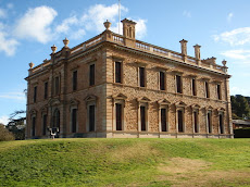
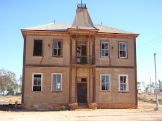
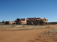
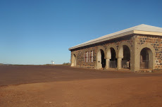
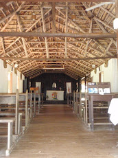
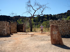
Wednesday, August 20, 2008

East from Geraldton to Laverton – Murchison goldfields and desert gateway

We are writing this whilst sitting at a park bench in the Wirabarra Conservation Park south of Port Augusta. It is damp under foot, with oh-so-bright green grass between many of the trees. It feels very strange, if not too cold as yet. The contrast with everything we have experienced for months past is so strong, and it is going to take a while to get used to again. Hopefully this verdure foretells of a wet Victoria.

We picked our way across country, away from Geraldton, with the weather now much improved. The countryside was aglow with Canola, planted to capitalise on the apparent break in the drought there. Within the hour we were on the road towards Mt Magnet and camped that night beside the Greenough River in readiness for a botanical visit to nearby Bindoo Hill Nature Reserve to indulge Helen’s latest passion. Helen had made contact with a colleague who lives on an outback station, called “Thundelarra” (the name now immortalised by J K Rowling as one of Harry Potter’s places, amazingly enough) who we visited for the next night’s stay. They sensibly de-stocked eight years ago at the start of the drought and have been making a living on the feral goats, for which there has been a strong market until recently. But their time on the property, in the one family’s hands for almost fifty years, will soon be over as they have sold to the Dept. of Environment & Conservation. We heard fascinating stories of remote life, particularly those involving home schooling with School of the Air. For the first year since 2000 the wild flowers had made an appearance, and they carpeted much of the place, and eastwards for a hundred kilometres or so. The Wreath Leschenaultia were much in evidence near Pindar, with travelling flora lovers descending on them in significant numbers.

From Mt Magnet we visited the National Trust listed old gold town of Cue (Queen of the Murchison), and explored the old mine sites and ghost towns that still speak through the decades of very different times. Not least was Big Bell. This town, gazetted in about 1934, boasted perhaps a hundred houses, an enormous two storey brick pub and a doubtless brassy social life, that all fell in a heap in 1954; the gold price fell through the floor and everyone upped stumps. There are going to be similar stories to be told after the current mining boom has passed us by. In fact the main storey to tell as we travelled eastwards is that of mining. The roads in WA are first class, and they need to be. If you drive up to a lookout and scan across the intervening country towards the horizon you will see road trains carrying ore of one variety or another, travelling from right and left, converging on the main road to the coast. In the other direction, and often with police escorts waving you aside, go dongas or vast assemblies of bright steelwork. Amazing what the Chinese revolution can achieve, and there are many WA residents who are very unhappy about it. General labour is simply not to be found.

North of Mt Magnet we found Walga Rock, drawn as we are by the sniff of rock art. We were not disappointed, and we enjoyed a night equal to any on this trip camped beside it. Walga Rock is a small version of Uluru covering perhaps 20 hectares, without the people. It was a magnificent place with an ancient aura that has you talking in whispers without realising it. Completely on our own apart from a small herd of feral goats the other side of the hill, it was euphoric.

The road forward took us to Leinster, a BHP town where we spent a night courtesy of the golf club because BHP were reworking the caravan park to accommodate more fellas (the tales we heard about cases of beer selling for $180 at nearby mining “towns” – one pub, ten dongas, that’s it - such as Agnew, were apparently true); Leonora, where we passed St Barbara gold mine owned by “neighbours” of ours who live on Mt Macedon. Then on to Laverton, a largely aboriginal town where we contacted the police to tell them of our imminent departure across the Great Victoria Desert. We really were on our best behaviour as we fuelled up, filled our water tanks to brimming, and headed north east out of Laverton towards the start of the Anne Beadell Highway. Within minutes we were blueing about which way to go, but all was made clear and we made our way along the first part of the route to White Cliffs, where we made camp amongst somewhat forbidding mulga scrub, ready for an early start on the job at hand.

Tuesday, August 5, 2008

Wildflowers by a beginner

Plant life in Western Australia particularly is very varied and beautiful, especially now that the spring wildflower season has started, so I thought it time to regale my botanically minded (thinking of you Jen K), and Landcare friends with some of the treats we have seen. My interest has been growing since the beginning – starting with the mallee, mulga and saltbush of the dry country of Mungo NP and Broken Hill, then the drought-stricken Flinders Ranges with Red Gums in the dry river and creek beds. Central Northern Territory’s desert with the marvellous Desert Park of Alice Springs was followed by the wet tropics of Kakadu and Darwin and the Kimberley with its characteristic savannah of grass/wood-lands and boab trees. Dampier Peninsula’s 3-layered pindan sand plains (acacias, smaller trees and shrubs, and spinifex), contrasted with the arid tropics of the ore-rich Pilbara region, and coastal and scrub heaths of Ningaloo/Cape Range, Shark Bay and Kalbarri. My fond hope is that the current rain will reach the Great Victoria Desert to enable a wildflower display for our homeward traverse along the remote 1300km Anne Beadell track. It comes out at Coober Pedy in SA. There are many steep learning curves this novice has barely begun to negotiate – geology, climate, landform just for starters. The debate about burning and fire management is another story. An extra challenge is understanding changing nomenclature and taxonomy (eg Bloodwoods and Ghost Gums are now Corymbias not Eucalypts). Traditional uses of indigenous plants for food and medicine is a fascinating topic, complicated by the Aboriginal names of plants which of course change depending on the language group. I found a booklet written by Aboriginal people at Lombardina about the plants used by Bardi people of the Dampier Peninsula in West Kimberley called Boonya bardag gorna – all trees are good for something. There are many others.

I have persuaded Ian to try a few botanical walks; these are far fewer than gorge treks. Walks have become very stop-start affairs for me as I stop to take photos or check the book for identification, while he continues at a steady pace or gives up and whale watches instead. Luckily we have two pairs of binoculars as of course I want to do that too, and we have been rewarded by the sight of migrating humpbacks and local dolphins off the coasts at Ningaloo, Cape Perron and Kalbarri. We are now staying with sister Ann and husband Graeme outside Geraldton and admiring the native garden they started two years ago. We were lucky to stay a night with Ann at Eurardy Reserve, a Bush Heritage Australia property just outside the Kalbarri National Park. Ann with the WA Wildflower Society helped survey the great plant diversity of Eurardy, which has over 900 species; this season promises to be a wildflower delight once more after the previous 2 years of drought. I was able to practice untapped grandmotherly skills on the second baby of the delightful couple who manage the Reserve while her mother drove us along sandy tracks to spot orchids and a Mallee Fowl nest among the many other delights of York Gum woodland, Mallee shrublands and sandplain heath. http://www.bushheritage.org.au/browse.asp?ContainerID=reserve_eurardy.

Since then Annie has been showing us the many delights in the sand plains around Geraldton. The nature reserves and roadside are veritable wild gardens which after a week of rain are bursting with new seedlings and flowers. She has demonstrated the patienceof Jove in helping me identify and label them.

PS Having left Geraldon we have travelled through the Murchison Goldfields area and back into Mulga and Spinifex country, seeing the first fields of daisies after years of drought at Thundelarra Station.

My plant snaps with captions are up at http://picasaweb.google.com/helenscott0/HelenSPlantAlbum

As my photography skills are at best marginal you may be interested in further sites like WA’s FloraBase http://florabase.calm.wa.gov.au/ - especially for identification

http://www.wildflowerswa.com - tourist guide to the what and where of WA’s 12,000 species.

From Shark Bay south to Geraldton


The first real civilisation you come to, around a

bend, is the sudden sight of deep green fields of young wheat and buildings near the road. Here is the evidence that this season will be kind to the farmers. This is the northern-most range for cropping, and it looked as though every available corner has been planted to recoup some of the losses of the past several years of drought. Our next sojourn was at Kalbarri, a lovely little place where the Murchison River squeezes out between the cliffs after cutting a winding path through the Kalbarri National Park. More gorges again, different forms and geology, always worth the effort. We had made contact with Helen’s sister Ann who lives in Geraldton by this stage, and arranged to back track a bit after Kalbarri, and to visit an interesting Bush Heritage property called Eurardy. Ann has spent many days over some years there, as a volunteer, mapping the vegetation and helping to return an old overworked property to its natural state. We had two nights at Kalbarri, with Bill & Jill in the caravan park, and walks along the cliff tops, and a not to be missed hilarious evening at Findlay’s – an outside BBQ fish place run by local fishermen (we think) with a very droll sense of humour.

Eurardy was very special, and by this time the wild flowers were beginning to come on strong. Lovers of native plants applaud this place, which is a safe haven for threatened flora, and the young couple Paul & Leanne who are currently improving the place do a great job. Bush Heritage is an interesting concept and it is worth a quick Google to find out more about it. Basically there are about twenty properties across the country that have been purchased so they can be returned to bush. (Helen’s blog post on Plants has more detail)

Overcast skies were the norm, and with the first scatterings of rain we made our way down to Geraldton, good food, grog and home comforts. We had been hoping we would be able to take a trip across to the Abrolhos Islands that lie just 60kms offshore, in Graeme and Ann’s fine new 800 KW jet diveboat that Graeme has designed himself. Sadly the weather for seven days has been cold and wet and that trip will have to be postponed indefinitely. Instead we have enjoyed the delights of Geraldton, and there are many. This is a vibrant town that is being developed as if there is no tomorrow, but at its heart it has everything in good measure. The National Trust has set aside the little hamlet of Greenough, about 30kms south along the road to Perth. This is a delight and well worth a visit. It was last inhabited in the 1960’s, but it is a largely intact village, once the administrative centre of the region, where you find two churches, courthouse, police quarters and gaol, shops, convent, and two schools, all built in stone with shingled roofs, and in one place. Nearby there is the Hampton Arms where a pint can be had. If you squint and cock your ear to the landlord and his midlands accent you could easily be in Staffordshire (but sadly without the real ale). There is however an abundant collection of good second hand books for sale.

And so, after ten days now, we have cleaned out the van, fixed this and that, fuelled up at a reasonable price ($1.85), watched about ten DVD movies, and are ready perhaps tomorrow for the next step along the path that now turns for home. The wild flowers are hitting the headlines here, and we are looking forward (with a little trepidation) to the Anne Beadell “Highway” that will take us 1300kms east across the continent. When that is completed we will pop out of the desert at Coober Pedy and turn towards Adelaide. Helen’s sister Margie, and Paul, will be giving us some well earned comforts before we finally get back into Victoria. I am not sure we are ready to leave this wonderful west coast, and to wind down this journey. It is catching. So beware, if any of you are giving thought to becoming grey nomads!

Monday, August 4, 2008

Shark Bay and Monkey Mia

By 10am the next day we were turning west off the North West Coastal Highway, towards Shark Bay. Shark Bay Marine Park, bounded by Dirk Hartog Island to the west, comprises the salty east arm called Hamelin Pool where the stromatolites are to be found at Shell Beach, and the west one, Denham Sound. They are separated by the Peron Peninsula with Cape Peron National Park at the northern tip, the small town of Denham on its western shore, and opposite on the eastern side is the famed Monkey Mia, where the dolphins take money out of tourist’s pockets. Our target for a couple of days was a spot at the northernmost point on Cape Peron, accessed through deep sand for about 50 kms. We saw Bill & Jill again on the road, and made plans to catch up with them again at Monkey Mia, then headed up the track rather late in the afternoon.

I found this challenging. With the sun low and casting long shadows across the sandy ruts, I wanted to keep a fair bit of speed on to avoid getting trapped. Occasionally there were deep, short gullies that matched our suspension dynamics and we had one “Oh shit” moment as the front end took off altogether and came crashing down from a height of about a metre. The sump guard is looking rumpled but thankfully there appear to be no serious consequences. We set up camp with a strong south easterly buffeting us through the night. It didn’t take long before I was thinking about the journey out again, especially climbing out up the same hill where we had the jump up problem. I couldn’t relax really, and after a long walk the next day along the head of the beach (where Nicolas Baudin and Francois Peron came ashore in 1803 and met the natives for the first time) we packed up, to tackle the 50 kms of now dreaded deep sand before I could feel comfortable again.

I dropped some more pressure out of the tyres, to about 12psi, and gingerly crawled out at mid day. Where was the problem? With the sun overhead the track was hard to read, but seemed lightly rutted compared with the journey in. We crossed the open clay pans (where the real problems come when it has been raining), straight up the hill, and over the jumps without even realising it! A valuable lesson was learnt, that has built confidence, as we contemplate our next stage, across the Great Victorian Desert next week. We were ready for some indulgence that evening after we had squeezed ourselves into the resort at Monkey Mia. Bill & Jill were waiting and we yarned over a packet of Kettle chips and three bottles of wine, protected in one of the BBQ shelters on the shoreline.

The dolphins are well managed there, very different from some years ago. There are two feeding times, and people are organised so that everyone gets a close up experience without interfering too much with the dolphins well being. They only give them about a fifth of their daily needs, and they only feed the mothers. This ensures their own hunting skills are what they rely on, that the mothers teach their young how to catch fish, and the males aren’t attracted at all. You get to stand in the water up to your knees and after your feet go blue you don’t feel the cold so much!

Sunday, August 3, 2008

From Ningaloo to Carnarvon


The complete absence of toileting was one reason to leave Winderabandi Point, at the north end of Ningaloo Station. Everything else about the place is magnificent. But time passes and as I keep reminding Helen, this is a reconnoitre and next time, like everyone else there, we’ll stay for weeks and weeks if the government will let us. Tyres down to 15 psi and gently does it on the throttle, and we crawled nicely out of the dunes and set off southwards.

This moving on is a wonderful part of what we are doing. Each time we leave somewhere it is with regret but as soon as you are on the road the excitement of the new takes over. Driving with a sense that you have done all you can to make sure you have reliability is part of it. I shouldn’t tempt fate but I do think the Toyota is magnificent. Would the Land Rover have done it all so well? I have my doubts. The knowledge there is a Toyo dealer around almost every corner is part of it of course. We haven’t seen an LR dealer at all! Anyway, we headed south through the once beautiful Coral Bay (it now resembles a Butlin’s Holiday Camp I’m afraid – the poms will understand), and joined Route 1 at Minilya Roadhouse, aiming for Carnarvon.

Clouds had been sitting on the southern horizon for days, and as the day drew to a close we were overcast and feeling wintery again. We fell short of Carnarvon and turned back NW up the coast to Quobba Point Blowholes and Quobba Homestead. Dusk was approaching. The lighthouse stood across to our left as we crested a saddle. With a great burst and like a whale breaching, a whoosh and roar of water burst vertically upwards in front of us, and there was the ocean below the cliff tops. The T junction in front of us was signed in very large letters, “King Waves Kill”, and we knew we were at a special place. We scrambled out of the car having parked as near the edge as we could, and cautiously moved towards the source of all the commotion, below which the ocean swells surged and crashed over shelving rock ledges. This was a magic moment. With dusk falling we turned up the coast a few more kilometres and set up camp at Quobba Homestead. This is a place straight out of a Tim Winton novel, and is close to where some of the German survivors from the Kormoran came ashore, after the battle with HMAS Sydney in 1941. At Quobba we met up with another couple of T Vanners, whose paths we kept crossing for days afterwards. We had a lot of fun with Bill & Jill from Fremantle.

With the destination of Shark Bay in our sights, and the weather again indifferent, we kept moving down to Carnarvon to replenish supplies. Carnarvon grows fruit with water from the Gascoyne River. A strong banana industry and also prawns that are sent all over the country keep the town economically sound. Development is there too, and you get the sense that this place will be a retirement destination, even as far from Perth as it is. It took three hours huddled in the car in the foreshore car park to get our last blog up, making us a bit late leaving, so we camped about 70 kms out along the highway, at a free camp spot. As we travelled there the first fields of white everlastings appeared, enough to gladden any heart. Helen is now very much involved learning as much as she can about the wildflowers, especially because the whole of the coastal region we were about to enter is renowned for them.

Thursday, July 17, 2008

Coral Coast : Exmouth and Ningaloo

Nanutarra Roadhouse couldn’t tempt us to buy diesel at $2.35, and as we had filled up at Tom Price at $1.93 we were content to cruise our way gently out of the Pilbara and through the Giralia Range, towards Exmouth, home of the Defence forces and a new resort in the making that reminded me of the Costa Brava in the 1960’s. Thank you Novotel and others. It will make a big difference to the local economy of course, but it brings with it enormous pressure to exploit the tourist potential of the Ningaloo Reef. We find the battle is now on.... but more of that to come. Pulling into the visitor centre in Exmouth, a little tired, we were approached by an attractive couple wearing their sunnies, breezily hailing us across the car park. We were both cranking back through the new chum list trying to place them. “Have we met before?” I asked. The lady peeled off her glasses and revealed a familiar grin “yes, we’re related!” she replied. Perhaps we’ve been on the road too long! There were Sue Clark and her friend Nick, telling us they had been following our travels with interest from this blog, and they were two days into their own 3 month vacation from Perth, to meet up with Heaton & Jen Clark in Broome; they are doing the coastal tour from Darwin.

The countryside is uplifted seabed, the Coral Coast. Where you walk up the ridges and gullies, the imprint of corals lie all around. Swimming with the whale sharks is the big attraction, and several whale sharks and hump back whales have apparently been spotted. The cost of frolicking in this manner is up to $450, which we thought too much to swallow. We travelled southwards down the coast, marvelling at the colour of the water inside the reef. Tall breaking rollers thunder in the distance, and spouting whales can be seen beyond, on their migration northwards. By the end of July the whale shark migration will have stopped for another year, until next April when the coral blooms again. With a gentle sea breeze and clear skies we have settled down for the next sojourn of a few days.

Within moments of arriving out of the National Park onto Ningaloo Station we struck up a conversation with a couple who filled us in on the dynamics here. They have been coming for many years along with several other families. The whole coast line for about 20 kms south is dotted with groups of caravans and tent sites nestled right into the dunes, within 5 metres of the waters’ edge at high water in some places. Apparently government is on the war path to have everyone moved back 200 metres into a caravan park, arguing that other conservation values have to be applied. Strangely, in the wings, resort developers are lobbying to construct two resorts along this coast. These regulars, some have been coming for 30 years (and it has to be said the dunes look in good shape to us), have just held a meeting of 300 or more, with politicians and the whole deal. This morning the letter of concern that was drafted was aired on ABC radio, arguing that this is the last place a traditional Australian way of holiday making can be enjoyed anywhere, and it should be made a heritage place. They have a point.

Today we have borrowed our new friend’s kayak and paddled about a kilometre out towards the breakers. A large ray, about 1.5 metres, keeping about 10 metres away, circled the kayak, whilst a turtle also swooped away from me, so fast. With the rollers now really loud and the water changing to a deep inkier blue at about 30 metres depth, you cast your eyes this way and that. Alone, really, perched on top of a flimsy wobbling attractive green and blue thing. There is a clear floor in the kayak and you can see right down beyond the sharks, to the bottom. With a delighted shiver it is time to turn around and head homewards with the breeze to carry you back.

The Pilbara inland

When we were in Karratha we obtained a permit to drive the Pilbara Iron road that follows the railway into the Hamersley Range, to Tom Price. Following our HEMA map faithfully, and having viewed a compulsory video about how to drive safely, we set off on a wonderful stretch of newly bituminised road. After 50 kms we realised we were on a road that was not officially open, so we sought directions from one of the road crew that sent us off on a wonderful adventure into lonely Pilbara country, different again from anything we had seen so far. These roads are owned and maintained solely for Pilbara Iron Co. and Rio Tinto or its offshoots, that send 7 trains a day to the coats, each 2 kms long, carrying 20,000 tonnes of ore. WA is about mining of course, and it comes as no surprise that the amazing Karijini NP was cut in two when the Marandoo mine was established in the late 1990’s, and it and a railway corridor cut through the middle. Some locals are not happy.

The first stop along the mine road was at Millstream-Chichester NP. True to its name, out of the arid and rocky country flows clear and sparkling fresh water, straight from the aquifer that touches the surface at this point. A true oasis exists here, with an interesting pastoral history linked back to Roebourne and Cossack days. Remains of the Chinaman’s garden are still there, with mementos from the last years when it was a working station, in the 1950’s. Streams a metre deep link lily pools full of fish.

When you reach Karijini NP further south, you are straight back into Gorge Mode, with Hamersley Gorge and its folded rock strata on the western doorstep. By this time the WA school holidays were in full swing, and we were competing with the hordes to find a site for the night. Persistence pays off, and not taking any notice of the many signs warning you away, when face to face with park staff we always managed to find a suitable, even well placed camp. Nothing prepared us though, for the sheer gorgeous drama of Weano, Hancock, Joffre and the many other gorges that link to form the centrepiece of this park. 100 metres deep, some of them only 10 metres wide, they take your breath away. You simply have to go there, being prepared to wade and clamber. When combined with some seriously bad signage that had us teetering on one or two wrong cliff edges, the experience was interesting, let’s say! A gentler and beautiful walk the following day was through Dales Gorge via cold pools and waterfalls and vegetation like wild figs, sedges, ferns, kurrajongs and the inevitable spinifex. We finished our sojourn in the park with a brief stop at mining town Tom Price, where we drove to the top of Mt Nameless (the aboriginal people always had a name for it of course – Jarndrunmunha, “place of wallabies”) to get an overview of the mine, and to grab some Next G coverage to call home and catch upon wonderful news about the birth of Ari Morton Holland to Hannah and Nat.

Wednesday, July 16, 2008

Pilbara coast : Port Hedland, Roebourne and Cossack


Eighty Mile Beach arcs between Broome and Port Hedland, with a well publicised campsite halfway along it. We found a spot behind the dune separating it from the beach, and again watched a now cooler sunset, in peace and some solitude. Broome is a gateway to and from the Dampier Peninsula and the Kimberly, with tropical vegetation that extends right across the top end. When you leave to the south, the landscap
e becomes semi arid heath quite rapidly. By the time you reach Port Hedland you know you have shifted into a different world altogether.

The red iron oxide lies over everything. This company town, the bridgehead for a lot of the iron ore trains, sports what were company houses, fibre cement sheet shacks of about 8 to 10 squares that ride the ridge overlooking the coast. All use solar panels that are thick with oxide and cannot be of much use. Chain wire front and side fences separate 15 metre blocks of land that are short of garden hobbyists. Our jaws dropped when we were told that these ridge top houses were selling for $1m. You might pay $80,000 for one in Woodend!.Such is the world of mining here in WA. The miners are distorting so much during this boom, and we hear increasing numbers of hopeful new owners are beginning to pay the price in Perth, as some suburbs there are now dropping.

West of Port Hedland lies the other mining town, Dampier; and between these is Karratha which was built as an overflow for Dampier, and the old towns of Roebourne and Cossack. Roebourne was established by pastoralists after explorer Gregory reported on the suitability of this country for carrying sheep (it wasn’t), and Cossack was built around the same time, being the first place that pearls were discovered and harvested. Broome took over the trade when the shell was exhausted. Cossack is now the host of the annual art prize, but is otherwise a ghost town of fine old stone buildings. The history is well documented in the old gaol, and Cossack sports a fine old courthouse. We watched a race horse being exercised on the beach, and went in search of our first petroglyphs since the Flinders Ranges – rock art engraved into the hard igneous rock.

As we neared the Burrup Peninsula, north of Dampier, we were told of the extraordinary quantity of petroglyphs to be found almost everywhere, and sure enough we soon saw images of turtles and wallabies, boomerangs and “strong men” with wonderful head dresses. This pic apparently represents white sailor arrivals. We stopped a night on the shelly beach at Hearson/s Cove, where Gregory first landed back in 1860 something. The entire landform is made up of jumbles of rock that appear half quarried and then left. Spinifex fills all the gaps, and euros squat and eye you carefully from otherwise inaccessible perches – we counted 10 early in the morning. As they move the rocks sometimes overbalance, making a “chink” sort of metallic sound, so rich in iron are they. Nestled in between the tall ridges sits an alien from another world. Woodside control most that happens up here on the Burrup Peninsula, and they have built part of their LNG plant near Hearson’s Cove. The contrast of searching amongst rocks for signs of aboriginal habitation, next to this scene from a sci-fi movie, was extreme. Across the peninsula though, lies Woodside’s main LNG plant, which is being expanded continuously to meet demand, particularly from China. It is a monumental project, and those of us who can remember noises about a small exploration company finding gas back in the 1980’s and who failed to buy, can rue our lack of courage!

Saturday, July 12, 2008

Broome


It was the 2nd July when we popped off the dirt from Dampier Peninsula on to the main road linking Broome with the rest of the world. Immediately we saw a sign to the Bird Observatory that also has some camping facilities, so we short cut all the hassles of being cheek by jowl in town, in favour of a superb spot on the big curve of Roebuck Bay, about 30 kms out. It was a good choice notwithstanding the additional dirt road, with very good services at low cost, information (a Kimberly rock art book for Helen!), and obviously, bird observing facilities. One morning we were blessed with fog that rolled in across the shallow turquoise bay, a
nd hung around well into the morning.

Broome is a most interesting and dynamic community that is expanding very fast. Don’t ask about house prices; like everywhere in WA they are enormous. The old town – Chinatown, is really charming, tucked behind mangroves, sheltered from the ocean swells (but not the cyclones of course). The place was built on pearling which supplied the world with natural pearl and mother of pearl, until the middle of last century. Plastic replaced pearl shell buttons, and so Broome pearlers developed the techniques for seeding pearls within the oysters. The Japanese were the main divers and also owners, and are well represented in Broome still, particularly in the cemetery where 919 of them are buried. The Historical Society’s Museum is an excellent way of learning about the town.

We couldn’t resist Indiana Jones at the world’s oldest open air cinema, Sun Pictures. The highlight of the evening was the arrival of the Qantas and Virgin Blue 737’s. An unusual characteristic of Broome is the proximity to the now almost international airport. Basically they land in the Coles car park next to the cinema, or so it seems. Just as Indiana was about to engage in some daring deed a thunderous rush of sound burst on us and the underside of the aircraft seemed to fill the space above, a swoop of red and silver, palm trees swaying and us bathed in a cooling swirling breeze of turbulent air. Fantastic! Just settled down and the Virgin repeated the excitement.

Sunsets in Broome occur over Cable Beach, and are not to be missed. The beach is extremely wide at low tides, and you can exercise the dog thoroughly between high and low water, as many do. Or dog walkers do. Large parties of like- minded holiday makers accumulate along the ridge overlooking the beach, on well cut lawns, in front of smart watering holes. Folding chairs snap open almost in unison as the sun yellows down. As if to cue, the old pearling lugger with gaff sails set, drifts across the sunway on the water, and the digital whirring and clicking begins, often switching to the procession of camels. Paganism is alive and well!

We met up with a NZ couple who had been with us on the Dampier Peninsula, and enjoyed a hilarious coffee and dinner with them at their caravan site (cheek by jowl – we chose the right place to stay out of town). Another evening, after looking for the dinosaur footprints on the low tide rocks at Gantheaume Point, we drove around to the wharf and enjoyed some very good fish and chips at a smart harbourside spot overlooking the quarantine station and the work trappings of the place. There is a lot of room for expansion of housing, and the roads that have been put in are ominously wide, with roundabouts of the largest dimensions. It might be best to visit sooner rather than later, but all in all we enjoyed the place very much. It is stylish in a way we haven’t seen in Australia before.

Part of the enjoyment is knowing that in moving on we are going to another source of interest or delight, and in that mood we fuelled up and headed down the road along the coast towards Port Hedland.